- Визуализиране в 2D (в режими севера нагоре или посоката на движение нагоре) и 3D перспектива. Поддръжка на релеф със сенки.
- Търсене по адреси, блокове, пресичащи се улици, населени места, махали, квартали, точки представляващи интерес (POI) и пощенски код
- Изчисляване на маршрути за различни превозни средства: автомобил, мотоциклет, камион, такси, линейка, автобус, велосипед (шосеен), велосипед (планински), пешеходен, използвайки градски транспорт, 4x4, ATV, лек ендуро мотоциклет, тежък ендуро мотоциклет, ролери, скейт борд и други
- Изчисляване на маршрути по различи критерии: Най-бърз, най-кратък, най-икономичен, най-лесен, най-труден, живописен/туристически, с най-малко изкачвания и спускания, установени градски маршрути, установени туристически маршрути и други
- Възможни избягвания на: магистрали, натоварени пътища, обратни завой, главни пътища, фериботи, павирани улици, разбити пътища, опасни пътища, пътища над определена надморска височина, пътища под определена надморска височина и други
- Локализация на интерфейса на български, английски, френски, немски, испански, италиански и турски език
- Гласова навигация на български, английски, френски, немски, испански, италиански и турски.
- TTS на български, английски, френски, немски, испански и италиански език – изговаряне на имената на улиците на изброените езици при гласова навигация
- Изговаряне на български, английски, френски, немски, испански, италиански и турски език на местоположението, изброявайки най-близки улици, обекти и адреси за хора с увредено зрение
- Офлайн (без връзка с интернет) превод при търсене от/на английски, немски, френски, италиански, испански, турски и български език
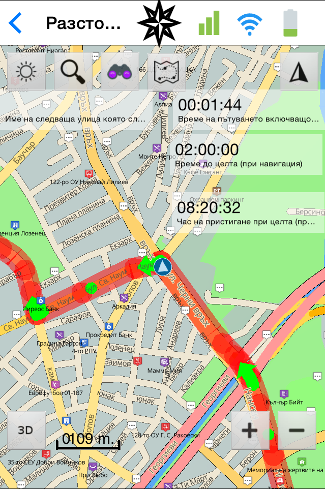
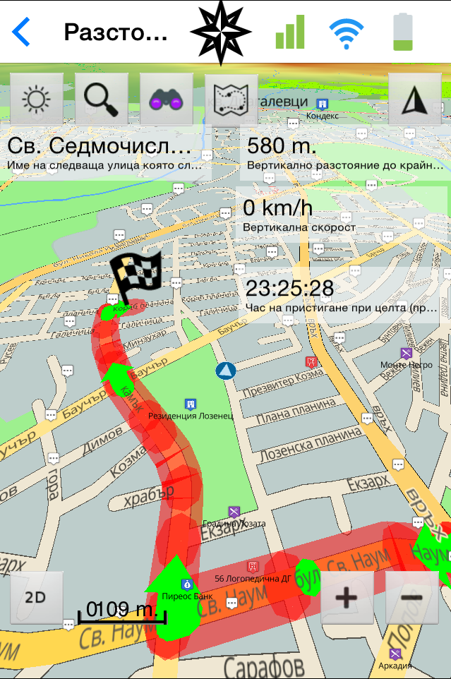
- Списък на предстоящите маневри при маршрутизиране
- Показване на максималната позволена скорост и аларма при превишаването ѝ
- Показване на знаци показващи разрешените посоки на движение
- Запазване на позиция и меню със списък на запазени позиции. Опция за запазване на позиция задавайки азимут и разстояние. Опция за изпращане по е-мейл в GPX файлов формат.
- Възможност за избор дали да се записва следа при движение или не. Възможност за запазване на следата и меню със списък на запазени следи и тяхно управление. Възможност на избор кои следи да се визуализират и цвят на визуализацията. Възможност за задаване на параметри, определящи колко детайлна да е следата с максимална резолюция една точка в секунда. Записването на следата има възможност да работи и във фонов режим или при загасен телефон.* Опция за изпращане по е-мейл в GPX файлов формат.
- Възможност да се начертае маршрут използвайки картата и/или методите за търсене. Възможност за запазване на маршрута и активирането му в последствие. Мениджър на маршрутите. Опция за изпращане по е-мейл в GPX файлов формат.
- Фото реалистичен изглед на кръстовище (Junction View)
- Lane Assist – функция, която помага за престояване в правилната лента преди пътен възел
- Поддръжка на потребителски POI точки с опция за известяване при приближаване ви дава възможност да заредите вашите камери срещу превишаване на скоростта
- Навигиране до снимка (при наличие на координати в EXIF-метаданните на снимката)
- Опция за избягване на път/местност чрез начертаване на забранена зона върху картата
- Интеграция с iCloud/GoogleDrive за Backup на потребителските точки, тракове и маршрути
|
 |